 WhatsApp Us Now
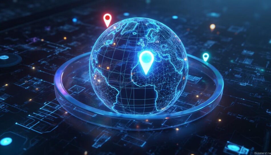
In today’s technology-driven world, location is more than just a geographic coordinate—it’s a powerful tool for businesses, governments, and individuals alike. GEO Services have transformed the way organizations interact with spatial data, providing critical insights for decision-making, marketing strategies, logistics, and much more. Whether it’s tracking customer behavior, optimizing supply chains, or mapping environmental data, GEO Services are at the forefront of technological innovation.
At Adomantra, we recognize the growing importance of GEO Services, and in this article, we will explore the top tools and platforms that enable organizations to harness the power of geospatial data effectively.
What Are GEO Services?
Before diving into the tools and platforms, it’s essential to understand what GEO Services are. GEO Services, short for Geospatial Services, refer to the suite of technologies and platforms that collect, process, analyze, and visualize geographic data. These services enable businesses to understand spatial relationships, predict trends, and make data-driven decisions based on location.
Some key applications include:
- Location-Based Marketing: Targeting customers based on their geographic location.
- Asset Tracking: Monitoring fleets, inventory, and other assets in real-time.
- Urban Planning: Assisting governments and urban planners in optimizing city infrastructure.
- Environmental Monitoring: Tracking environmental changes, such as deforestation or pollution.
By leveraging GEO Services, organizations can gain actionable insights that improve efficiency, reduce costs, and enhance customer experiences.
Benefits of Implementing GEO Services
Implementing GEO Services offers numerous benefits across industries. Some of the most significant advantages include:
- Enhanced Decision-Making
Geospatial data provides a comprehensive understanding of location-based trends. This enables businesses to make more informed decisions regarding marketing strategies, logistics, and expansion plans. - Operational Efficiency
GEO Services help track assets, optimize routes, and monitor workflows in real-time, reducing delays and operational costs. - Improved Customer Engagement
Businesses can target their audience more accurately with location-based promotions and personalized services. - Risk Management
Organizations can analyze geographic risks, such as natural disasters or market saturation, to mitigate potential losses. - Competitive Advantage
Companies using GEO Services gain a strategic edge by leveraging data-driven insights to outpace competitors.
Top Tools and Platforms for Implementing GEO Services
To effectively implement GEO Services, it is essential to choose the right tools and platforms. Below, we will explore the most popular and efficient options available today.
1. ArcGIS by Esri
Overview:
ArcGIS is a leading geographic information system (GIS) platform widely used for mapping and spatial analysis. It allows users to visualize, analyze, and interpret geographic data.
Key Features:
- Interactive mapping and visualization.
- Advanced spatial analysis tools.
- Cloud-based data sharing and collaboration.
- Integration with AI and IoT devices for real-time analytics.
Why It’s Ideal for GEO Services:
ArcGIS offers comprehensive solutions for businesses looking to implement GEO Services at scale. Its powerful analytics and mapping capabilities make it suitable for industries ranging from urban planning to logistics.
Use Case Example:
Retail companies can use ArcGIS to analyze foot traffic patterns and optimize store locations for maximum profitability.
2. Google Maps Platform
Overview:
Google Maps Platform provides developers with APIs to integrate geospatial functionalities into web and mobile applications.
Key Features:
- Real-time location tracking.
- Route optimization for logistics and delivery services.
- Geocoding and reverse geocoding.
- Customizable maps and data overlays.
Why It’s Ideal for GEO Services:
Google Maps Platform is perfect for businesses seeking to integrate location-based services seamlessly into their apps. Its robust APIs and global mapping coverage make it highly reliable.
Use Case Example:
Food delivery companies can optimize delivery routes and track drivers in real-time, ensuring timely service and customer satisfaction.
3. QGIS (Quantum GIS)
Overview:
QGIS is an open-source GIS platform that allows users to create, edit, visualize, and analyze spatial data.
Key Features:
- Free and open-source, reducing costs for organizations.
- Supports multiple data formats.
- Advanced plugins for extended functionality.
- Strong community support and documentation.
Why It’s Ideal for GEO Services:
QGIS provides a cost-effective solution for businesses and researchers who need powerful geospatial analysis without the high licensing fees.
Use Case Example:
Environmental agencies can use QGIS to monitor deforestation patterns and predict potential environmental impacts.
4. Mapbox
Overview:
Mapbox is a flexible mapping and location platform for developers, providing APIs and SDKs to integrate custom maps and geospatial data into applications.
Key Features:
- Highly customizable maps.
- Real-time location and navigation services.
- Data visualization tools for geospatial analysis.
- Scalable infrastructure for large datasets.
Why It’s Ideal for GEO Services:
Mapbox is particularly useful for mobile applications and web platforms that require highly interactive and visually appealing maps.
Use Case Example:
Ride-hailing apps can integrate Mapbox to display real-time vehicle locations and provide optimized routing for users.
5. HERE Technologies
Overview:
HERE Technologies offers mapping, location data, and geospatial services for businesses across industries.
Key Features:
- Real-time traffic and location data.
- Route planning and logistics optimization.
- Fleet management solutions.
- Extensive geospatial datasets for analytics.
Why It’s Ideal for GEO Services:
HERE’s extensive datasets and analytics capabilities make it suitable for transportation, logistics, and smart city applications.
Use Case Example:
Logistics companies can use HERE Technologies to plan efficient delivery routes, monitor traffic patterns, and reduce fuel costs.
6. GeoServer
Overview:
GeoServer is an open-source server platform designed for sharing and editing geospatial data.
Key Features:
- Supports Web Map Service (WMS) and Web Feature Service (WFS).
- Easily integrates with other GIS software.
- Handles large-scale spatial datasets efficiently.
- Open-source with strong community support.
Why It’s Ideal for GEO Services:
GeoServer is ideal for organizations that require centralized geospatial data management and sharing across multiple platforms.
Use Case Example:
Government agencies can use GeoServer to share city planning maps and zoning information with the public and stakeholders.
7. Leaflet
Overview:
Leaflet is a lightweight open-source JavaScript library for interactive maps.
Key Features:
- Mobile-friendly and fast performance.
- Easy integration with various mapping APIs.
- Supports markers, layers, popups, and custom tiles.
- Extensible with plugins for additional functionality.
Why It’s Ideal for GEO Services:
Leaflet is perfect for developers creating web-based maps with interactive elements, especially when lightweight performance is critical.
Use Case Example:
Tourism websites can use Leaflet to create interactive maps highlighting points of interest, hotels, and attractions.
8. Carto
Overview:
Carto is a cloud-based platform for advanced spatial analysis and visualization.
Key Features:
- Predictive analytics using geospatial data.
- Location intelligence dashboards.
- Integration with multiple datasets and APIs.
- Supports machine learning for spatial analysis.
Why It’s Ideal for GEO Services:
Carto enables businesses to transform raw geospatial data into actionable insights, making it ideal for strategic decision-making.
Use Case Example:
Retail chains can analyze demographic data to determine optimal store locations and predict customer behavior.
Choosing the Right Platform
Selecting the right tools for implementing GEO Services depends on several factors:
- Business Objectives: Determine whether you need advanced analytics, real-time tracking, or interactive maps.
- Budget: Consider open-source options like QGIS or GeoServer for cost-effective solutions.
- Scalability: Ensure the platform can handle growing datasets and increased user demands.
- Integration: Check whether the tool integrates with existing software and APIs.
- Ease of Use: User-friendly platforms like Google Maps Platform and Mapbox reduce development time.
At Adomantra, we assist businesses in evaluating these tools and choosing the best fit for their GEO Services strategy.
Future Trends in GEO Services
The landscape of GEO Services continues to evolve rapidly. Some emerging trends include:
- AI-Powered Geospatial Analytics
Artificial intelligence is being integrated into geospatial platforms to predict trends, optimize routes, and automate data analysis. - 3D Mapping and Visualization
Advanced 3D modeling enables more immersive visualizations for urban planning, architecture, and simulation applications. - IoT Integration
IoT devices provide real-time geospatial data, enhancing fleet management, environmental monitoring, and smart city applications. - Cloud-Based GIS
Cloud platforms allow for collaborative geospatial analysis and reduce infrastructure costs, making GEO Services more accessible. - Location Privacy and Security
As location-based services grow, privacy regulations are becoming crucial, emphasizing secure data collection and processing.
By keeping up with these trends, businesses can ensure their GEO Services remain innovative and impactful.
Conclusion
GEO Services are no longer optional—they are a necessity for businesses seeking to leverage location data for strategic advantage. Platforms like ArcGIS, Google Maps Platform, QGIS, Mapbox, HERE Technologies, GeoServer, Leaflet, and Carto provide powerful tools for integrating geospatial capabilities into various operations.
By carefully selecting the right platform, organizations can enhance decision-making, optimize operations, improve customer experiences, and gain a competitive edge. Adomantra is committed to helping businesses navigate this complex landscape, ensuring they leverage GEO Services to their full potential.
Investing in the right GEO Services tools today can translate into smarter decisions, greater efficiency, and sustainable growth tomorrow.
Frequently Asked Questions (FAQ) About GEO Services
1. What are GEO Services?
Answer:
GEO Services, or Geospatial Services, are technologies and platforms that collect, process, analyze, and visualize geographic data. They help businesses and organizations make data-driven decisions based on location, such as optimizing logistics, targeting customers, monitoring environmental changes, and planning urban infrastructure.
2. Why are GEO Services important for businesses?
Answer:
GEO Services allow businesses to:
- Improve operational efficiency through real-time tracking.
- Make informed decisions based on spatial data.
- Deliver personalized and location-based marketing.
- Mitigate risks by analyzing geographic and environmental factors.
- Gain a competitive edge through insights that competitors may not have.
3. Which industries benefit the most from GEO Services?
Answer:
Almost every industry can benefit from GEO Services, but some key sectors include:
- Retail: Optimizing store locations and understanding customer behavior.
- Transportation & Logistics: Fleet tracking and route optimization.
- Urban Planning & Government: Efficient infrastructure and city planning.
- Environmental & Agriculture: Monitoring climate change, pollution, or crop health.
- Tourism: Creating interactive maps and location-based services for travelers.
4. What are the top tools for implementing GEO Services?
Answer:
Some of the best tools and platforms include:
- ArcGIS – For advanced mapping and spatial analysis.
- Google Maps Platform – For location-based services and APIs.
- QGIS – Open-source GIS for analysis and visualization.
- Mapbox – Customizable interactive maps for apps.
- HERE Technologies – Real-time traffic, navigation, and fleet management.
- GeoServer – Open-source platform for sharing geospatial data.
- Leaflet – Lightweight library for web-based interactive maps.
- Carto – Cloud-based platform for spatial analysis and location intelligence.
5. How do I choose the right GEO Services platform?
Answer:
Consider the following factors:
- Business Objectives: Decide if you need analytics, real-time tracking, or interactive maps.
- Budget: Open-source tools like QGIS or GeoServer are cost-effective, while ArcGIS and Mapbox may require licenses.
- Integration: Ensure the platform integrates smoothly with your existing systems.
- Scalability: Choose platforms that can handle large datasets and user demands.
- Ease of Use: Platforms with intuitive interfaces reduce training and development time.
6. Can GEO Services be used in mobile applications?
Answer:
Yes, many GEO Services platforms provide APIs and SDKs for mobile app integration. For example, Google Maps Platform, Mapbox, and Leaflet allow developers to embed interactive maps, track real-time locations, and provide navigation features directly in mobile apps.
7. Are there open-source options for GEO Services?
Answer:
Yes, several reliable open-source platforms include:
- QGIS: Full-featured GIS software for spatial analysis.
- GeoServer: Platform for sharing and editing geospatial data.
- Leaflet: Lightweight library for interactive web maps.
These options are cost-effective and highly customizable, ideal for businesses or researchers with limited budgets.
8. How does GEO Services help in logistics and transportation?
Answer:
GEO Services optimize transportation by:
- Planning efficient delivery routes.
- Tracking fleet and shipments in real-time.
- Reducing fuel and operational costs.
- Analyzing traffic patterns and predicting delays.
Companies using platforms like HERE Technologies or Google Maps Platform can significantly improve delivery times and customer satisfaction.
9. Can GEO Services support environmental monitoring?
Answer:
Absolutely. GEO Services can monitor environmental changes such as deforestation, air and water quality, natural disasters, and climate change. Tools like QGIS and ArcGIS allow governments and NGOs to visualize environmental data, make predictions, and plan interventions.
10. How is AI integrated with GEO Services?
Answer:
AI enhances GEO Services by enabling predictive analytics, automating data analysis, and generating actionable insights from large geospatial datasets. For instance, AI can help predict traffic congestion, forecast environmental risks, or optimize marketing campaigns based on location data.
11. What is the future of GEO Services?
Answer:
Future trends in GEO Services include:
- AI-powered spatial analytics.
- 3D mapping and immersive visualizations.
- Integration with IoT devices for real-time monitoring.
- Cloud-based GIS solutions for collaboration and scalability.
- Focus on privacy and data security in location-based applications.
Organizations leveraging these innovations can gain a significant advantage in efficiency, decision-making, and customer engagement.
12. How can Adomantra help with GEO Services implementation?
Answer:
Adomantra specializes in guiding businesses through the adoption of GEO Services. From choosing the right platforms to integrating geospatial tools into existing operations, Adomantra ensures organizations maximize the value of location-based insights for better decision-making and operational efficiency.
Read More: thestarbiznews


